Strategic noise maps
What is a strategic noise map?
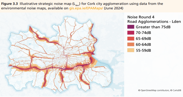
A strategic noise map shows estimated levels of environmental noise from major roads, railways, airports and large urban areas. It helps identify where people may bee exposed to higher levels of noise and provides a picture of noise across a wide area. The maps are produced using computer models that use information such as traffic volumes, train movements and flight activity to estimate noise levels. Noise levels are displayed using different colours to show how noise varies across an area.
Noise indicators
Strategic noise maps use two indicators to assess environmental noise:
- Lden (day-evening-night) measures average noise over a 24-hour period and takes into account that people are generally more sensitive to noise during the evening and night.
- Lnight (night-time level) measures average noise during the night and is used to assess potential impacts on sleep.
Noise levels are measured in decibels (dB) and are based on average noise levels over a full year. The indicators use the following time periods:
- Day: 07:00 to 19:00
- Evening: 19:00 to 23:00
- Night: 23:00 to 07:00
Strategic noise maps are prepared in rounds, and updated every five years under the Environmental Noise Regulations. The next round of maps, Round 5, is due to be published at the end of 2027. They provide important information to support noise action planning and the management of environmental noise in Ireland. The EPA oversees the national noise mapping process and coordinates reporting under the Regulations.
Where can I get the noise mapping data?
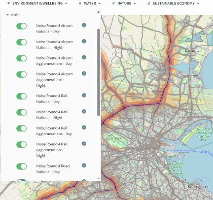
Strategic noise mapping data for Ireland is available through EPA Maps. The maps allow you to view estimates noise levels from major roads, railways, airports and urban areas, helping you understand noise exposure in different locations. Noise levels are displayed using colour-coded maps and can be viewed for both Lden (day-evening-night_ and Lnight (night-time noise).
You can explore the latest published noise maps by visiting the EPA Maps application and selecting Environment and Wellbeing > Noise. Additional information and metadata are also available for each dataset as shown below.
Why are strategic noise maps important?
Strategic noise maps help improve understanding of environmental noise and where people may be exposed to higher noise levels. They provide the evidence needed to develop noise action plane, identify priority areas for action, and support efforts to reduce the harmful effects of environmental noise on health and wellbeing. In Ireland, road traffic, particularly in urban areas, is the main source of environmental noise. Measures such as improved road design, lower speed limits, quieter road surfaces and low-emission zones can help reduce noise impacts.
Who is responsible for strategic noise mapping?
Strategic noise maps are prepared by a number of organisations, depending on the source of the noise being assessed. Local authorities are responsible for mapping noise from non-national roads, while other designated bodies are responsible for national roads, railways, airports and large urban areas.
The EPA oversees the national noise mapping process, provides guidance to the organisations responsible for preparing the maps and coordinates reporting under the Environmental Noise Regulations. Strategic noise maps are updated every five years, and the results are reported to the European Environment Agency (EEA).
The main organisations responsible for strategic noise mapping in Ireland are:
- Local authorities - non-national roads
- Transport Infrastructure Ireland (TIL) - national roads and the Luas
- Iarnród Éireann (Irish Rail) - heavy rail
- daa (Dublin Airport Authority) - Dublin Airport noise mapping
- Local authority agglomerations - noise mapping for Dublin, Cork and Limerick urban areas
The latest strategic noise maps are available through EPA Maps and are used to support the development of noise action plans and improve understanding of environmental noise across Ireland.
Recent strategic noise mapping updates
The Round 4 strategic noise maps show that road traffic is the main source of environmental noise in Ireland, particularly in urban areas. The mapping results help identify locations where people may be exposed to higher levels of noise and provide important information for developing noise action plans. Round 5 noise mapping is due to be published at the end of 2027.
The data highlights the need for measures that can reduce the impact of noise on health and wellbeing. These may include improvements to road design, lower traffic speeds, quieter road surfaces and other measure to reduce noise at source. Strategic noise mapping also helps track trends over time and supports evidence-based decision making on environmental noise management. Please see State of the Environment Report – Chapter 3: Environmental Noise for more information.