Latest Assessment Publications
SEA of local authority Land Use Plans - EPA recommendations and resources
Year: 2026
This document forms part of submissions we make on local authority land-use plans undergoing strategic environmental assessments (SEA). It includes: key environmental recommendations to consider; information on recently published relevant EPA reports; links to useful environmental resources for local authorities carrying out SEA of land-use plans. It is updated regularly and was last uploaded on 7th April 2026
.png)
EEA Eionet Ireland Network Brochure 2026
Year: 2026
National Focal Points (NFPs) serve as the main national contact points within the European Environment Information and Observation Network (Eionet), and the European Environment Agency (EEA) works closely with them. Appointed by each EEA member country, NFPs are typically based in a national environmental agency or environment ministry. In Ireland, the Environmental Protection Agency (EPA) acts as the NFP, coordinating the exchange of environmental information with the EEA and other partners. In this role, the EPA maintains and further develops the national network, while also facilitating and coordinating contacts, requests, and information deliveries between national and EU levels. This summary booklet was updated in March 2026.
SEA Spatial Information Sources Inventory
EPA Spatial Data Inventory, November 2025
Year: 2025
This inventory of spatial information sources can be used to help in preparing SEA Environmental Reports and the associated environmental assessments with up to date environmental information. Data sources/links include air quality, climate, biodiversity, flora, fauna, geology, soils, hydrology and water quality. This inventory was last updated in November 2025 and may not be exhaustive. (See Disclaimer below for terms of use).
Eionet Ireland Network Brochure August 2025
Year: 2025
National Focal Points (NFPs) are the primary national contact points in the Eionet and the EEA works closely with them. Typically based in a national environment agency or environment ministry an NFP is appointed by their EEA member country. The Environmental Protection Agency acts as the NFP for Ireland, coordinating environmental information exchange with the EEA and others. In its NFP role, the EPA maintains and develops the national network. It also facilitates and coordinates contacts, requests and deliveries between national and EU level. The summary booklet was updated in August 2025.
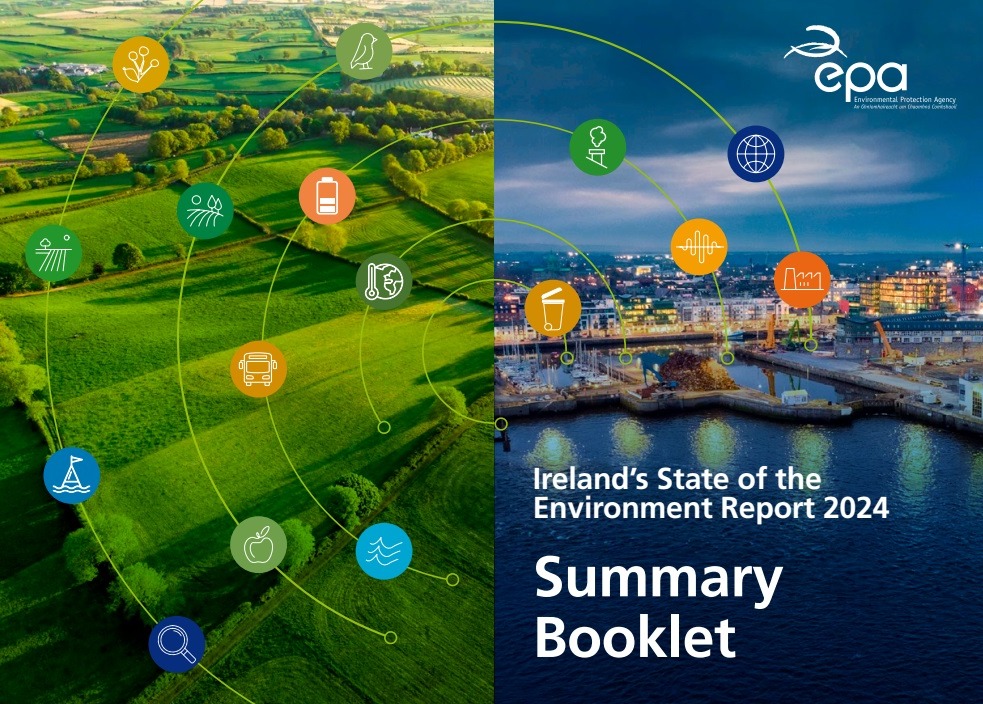
State of Environment Report Ireland Summary Booklet 2024
Year: 2025
This summary booklet presents the 5 key priorities for Ireland, chapter key messages, environmental scorecard and a snapshot of selected environmental and socio-economic indicators from the State of Environment Report 2024.
Environment and Agriculture
Year: 2025
Presentation by Dr Jenny Deakin, EPA at the EPA State of the Environment Conference 2024
Transitioning our Energy Systems
Year: 2025
Presentation by Prof. Brian Ó Gallachóir, UCC at the EPA State of the Environment Conference 2024.
How the Environment in Ireland impacts health
Year: 2025
Presentation by Dr Aisling O'Connor, EPA at the EPA State of the Environment Conference 2024.
Waste to a Circular Economy – Progress Update
Year: 2025
Presentation by Warren Phelan, EPA at the EPA State of the Environment Conference 2024.
Environmental Noise in Ireland
Year: 2025
Presentation by Tony Dolan, EPA at the EPA State of the Environment Conference 2024.
Nature in Ireland
Year: 2025
Presentation by Dr Hugh Feeley, EPA, at the EPA State of the Environment Conference 2024.
Ireland's Marine Environment
Year: 2025
Presentation by Dr Robert Wilkes, EPA at the EPA State of the Environment Conference 2024.
Protecting our Water Environment in Ireland
Year: 2025
Presentation by Dr Wayne Trodd (Senior Scientific Officer, EPA to December 2024), at the EPA State of the Environment Conference 2024.
Land Use
Year: 2025
Presentation by Fiona O'Rourke, EPA at the EPA State of the Environment Conference 2024.
Air Quality in Ireland
Year: 2025
Presentation by Patrick Kenny, EPA at the EPA State of the Environment Conference 2024.
State of the Environment 2024, Key Insights and Messages
Year: 2025
Presentation by Andy Fanning, EPA at the State of Environment Conference 2024.
Europe’s Environment 2050,The Challenges in Transition
Year: 2025
Presentation by Leena Ylä-Mononen, Executive Director, European Environment Agency at the State of Environment Conference 2024.
Paths to achieving our Climate Goals
Year: 2025
Presentation by Mary Frances Rochford, EPA at the State of the Environment Conference 2024.
Food Systems: Food Vision Dashboard
Year: 2025
Presentation by Aidan Gormley, Department of Agriculture, Food and Marine at the European Environment Agency Ireland country visit 17 October 2024.