ICOS Ireland
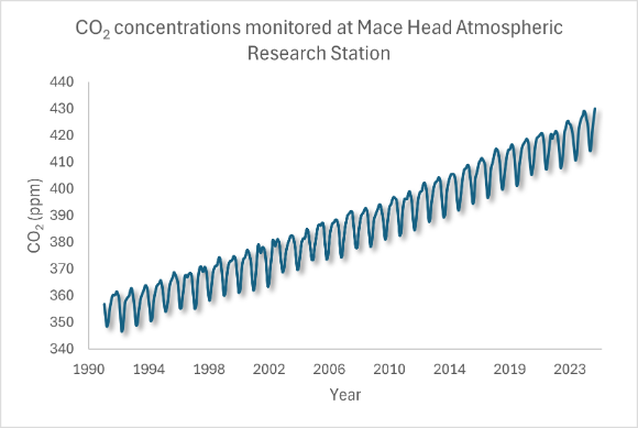
ICOS Ireland data is collected from atmosphere, ecosystem and ocean stations. Data from the Mace Head Atmospheric Research Station in Galway shows clear annual increases in carbon dioxide concentrations, combined with a strong seasonal cycle reflecting the importance of natural and managed carbon sinks (see graph below). These data mirror the global trends of increasing carbon dioxide and enhance our understanding of the drivers of climate change in Ireland and interactions between atmosphere, land and ocean.
Ireland and ICOS
Ireland became a full member of the ICOS ERIC in January 2023. As a member of ICOS, Ireland has access to the full resources of the ICOS ERIC and is a member of its decision making body, which meets as the ICOS General Assembly twice yearly.
ICOS resources include:
- Expert scientific networks and supports for atmospheric, ocean and ecosystem measurements provided by the three ICOS Thematic Centres.
- Instrument calibration standards and reference gases, software analysis systems and tools, and supports for equipment, training and measurements.
These ensure that data from ICOS stations and platforms in Ireland are of the highest quality and recognised as meeting global standards.
The ICOS Ireland network is comprised of:
- 4 atmosphere stations
- 5 ecosystem stations
- 1 ocean station
These stations are managed by 10 organisations, including government agencies, government departments, and three universities. The EPA manages Ireland’s engagement with ICOS and hosts the ICOS focal point.
Data Access
Once certified by ICOS, data from ICOS stations, including the Irish network, are freely accessible and visualised through the ICOS data portal (Figure 2) or, where necessary, by contacting the station operator (see tables below).
ICOS Ireland Stations
ICOS Ireland brings atmospheric data for key locations on the western boundary of Europe. These include flagship stations such as Mace Head which is part of the GCOS, GAW, EMEP and AGAGE networks, and provides observational data to key global and regional stations from the west of Ireland. It is complemented by data from stations at Valentia Island which is a GAW regional station in the southwest, Carnsore Point (southeast), and Malin Head (north).
Ireland’s ecosystem stations provide unique data on peatlands and grasslands for western Europe as well as its forest station. These stations are supplemented by other observations in Ireland which provide data on how ecosystems are responding to management, as well as weather and climate-related drivers.
The network's ocean observations provide key data on changes to ocean carbon content as well as other variables. In combination, data from Ireland and Europe provide an important resource for analysis of key earth systems and how these can contribute to addressing climate change, and are responding to it.
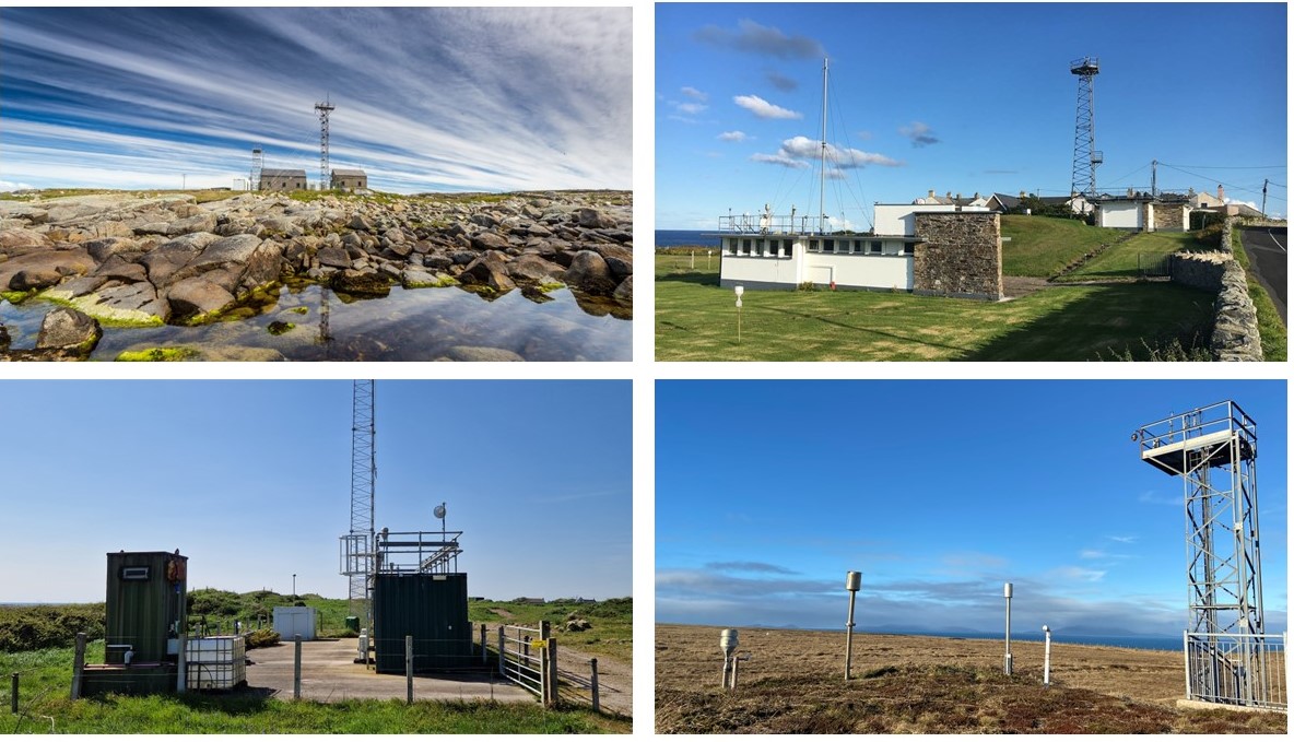
Atmosphere Stations
Atmosphere stations measure greenhouse gases in the air. These measurements help us understand:
- Where the gases come from (natural or human sources)
- How they are transported through the atmosphere
- How they affect the climate system
Each station collects greenhouse gas data continuously and also records weather conditions. Most are located in remote or elevated areas to capture regional trends. Ireland has four atmosphere stations strategically located across the country. All are Class 2 and operated by the EPA or Met Éireann.
Table 1: Atmosphere stations in the Irish network
| Station Name | Station Type | Class | Lead Body | Start Year | Contact |
|---|---|---|---|---|---|
| Mace Head | Coastal | 2 | EPA | 2010 | Damien Martin - damien.martin@universityofgalway.ie |
| Malin Head | Coastal | 2 | EPA | 2010 | Damien Martin - damien.martin@universityofgalway.ie |
| Carnsore Point | Coastal | 2 | EPA | 2010 | Damien Martin - damien.martin@universityofgalway.ie |
| Valentia | Coastal | 2 | Met Éireann | 2020 | Damien Martin - damien.martin@universityofgalway.ie |
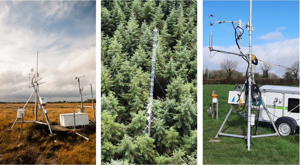
Ecosystem Stations
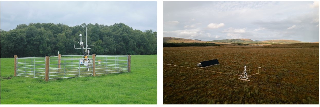
Ecosystem stations track how greenhouse gases move between land and the atmosphere. This helps scientists understand how different landscapes - such as forests, bogs and grasslands - store or release carbon. Stations are placed in areas that represent the local environment. Instruments are mounted on towers and measure gases, weather, soil and plant conditions. Ireland has five ecosystem stations, covering peatlands, grasslands and forests. These stations are either Class 2 or Associate stations and are operated by Teagasc, National Parks and Wildlife Service, and the Department of Agriculture, Food and the Marine.
Table 2: Ecosystem stations in the Irish network.
| Station Name | Station Type | Class | Lead Body | Start Year | Contact |
|---|---|---|---|---|---|
| Clara Raised Bog | Peatland | Associate | NPWS | 2018 | Matthew Saunders - saundem@tcd.ie |
| Leam West | Peatland | Associate | NPWS | 2025 | Shane Regan - shane.regan@npws.gov.ie |
| Doory | Grassland | Associate | Teagasc | 2024 | Rachael Murphy - rachael.murphy@teagasc.ie |
| Johnstown Castle | Grassland | 2 | Teagasc | 2018 | Rachael Murphy - rachael.murphy@teagasc.ie |
| Dooary | Forest | 2 | DAFM | 2005 | Brian Tobin - brian.tobin@ucd.ie |
Ocean Station
The ICOS ocean stations monitor carbon in the sea. They can be either Fixed Ocean Stations, or Ships of Opportunity (SOOP) and collect data on:
- Carbon dioxide in seawater
- Sea temperature and salinity
- Other related variables
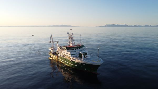
This helps track how oceans absorb carbon and how this affects climate and ocean health. Ireland’s ocean station is based on the RV Celtic Explorer, a research vessel that travels the North Atlantic collecting high-quality data during its voyages. Data from this station also contributes to global efforts like the Surface Ocean CO₂ Atlas (SOCAT) and the Global Carbon Budget.
Table 3: Ocean station in the Irish network
| Station Name | Station Type | Class | Lead Body | Start Year | Contact |
|---|---|---|---|---|---|
| RV Celtic Explorer | SOOP | 2 | Marine Institute | 2017 | Margot Cronin - Margot.cronin@marine.ie |