Land and Soil

The environmental roles and functions provided by different soils are increasingly being recognised. There is now a greater awareness of the need to protect soils and manage their use in a sustainable manner and of the wider benefits that can accrue.

Current trends

Aerial image of Galway

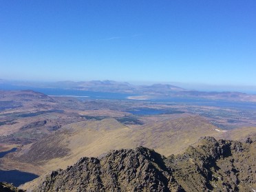
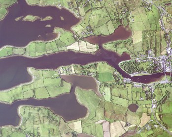
The interactions between human activities, such as farming, forestry and the built environment, are linked with processes that shape Ireland's environment, landscape and biodiversity. Land cover describes what is visible on the land surface. Land use describes the use or uses the land has been put to from a human perspective.

The CORINE (Co-ORdinated INformation on the Environment) data series has become a key data source for informing environmental and planning policy on a national and European level. 

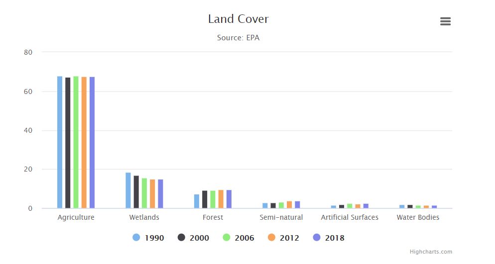
The most recent assessment (CORINE 2018) shows that agriculture is the primary Land Use Land Cover (LULC) type within Ireland (67.6% of national land cover), followed by wetlands (14.9%) and forestry (9.5%). 

The Ordnance Survey of Ireland and the EPA are working on developing a high-resolution map of Ireland to be completed in 2021. Based on high resolution aerial images and the integration of sectoral data, the map will allow for a much more consistent picture of national land cover. The EPA is also developing a national land use map for Land Use, Land Use Change & Forestry (LULUCF). 

Learn more about current trends in land use and land cover

Causes of land use changes

Image of Carrauntuathil, Kerry

The latest CORINE 2018 data indicates that the main change in land cover since 2019 has been in losses from agriculture to forestry and artificial areas. Wetlands too have reduced. Since 1990, wetlands have reduced by 258,800 hectares. The primary transition has been to forestry and the re-mapping of intertidal flats. 

Though the overall area of artificial surfaces remains low in Ireland compared with that in other EU Member States, artificial areas have increased in area by a significant 65 per cent since 1990. These changes have mainly impacted on losses in agricultural areas, with some smaller losses in forestry and wetland areas. Most of the increase in forestry relates to commercial coniferous plantations.

Population increase and settlement growth are the principal causes of land use changes in urban areas. EPA research shows that the main soil quality pressures in Ireland appear to relate to surface sealing (urbanisation).

Soil contamination can occur as a result of unauthorised waste-related activities, historical activities, leakages and accidental spillages of chemicals. There is currently no specific contaminated land policy in Ireland and therefore no legislation in place to deal with it. However, the EPA is responsible for enforcing the remediation of contamination identified at EPA-licensed facilities. 

Learn more about the causes of land use changes


What's being done

Clew Bay

Good spatial planning can optimise economic development opportunities, ecosystem services, reduce human exposure to environmental pressures and reduce social inequities. The importance of clean and well-protected “green” and “blue spaces” such as parks, ponds and wild areas in the urban landscape is now recognised as a key part of urban landscapes that are needed for healthy communities.

Addressing the national level resolution gap in land cover mapping remains a challenge and requires collaboration between many organisations and government departments. The Ordnance Survey of Ireland is developing a high-resolution map in partnership with the EPA, as part of a national integrated land cover mapping programme. The EPA also aims to develop a national land use map to assist in reporting under LULUCF Regulations.

The establishment of a national soil map as part of the EPA-funded Irish Soil Information System Project in 2014 is assisting soils management planning and related policy implementation. 

Learn more about what's being done


Outlook

Image of Blackrock Castle Cork City

Soils, land cover and landscapes are resources that need to be protected, monitored and managed. The National Planning Framework, adopted in 2018, is the top-level land use plan in Ireland. It is implemented at a regional level by the Regional Spatial Economic Strategies.

Integrating the National Landscape Strategy into land use planning, will allow us to progress sustainable landscape management practices. We must also support continued collaborative research to inform decision making that may affect soils, land use and landscapes.

Through the national Catchment-based Flood Risk Assessment and Management (CFRAM) programme, the OPW is also considering the potential for significant increases in flood risk due to climate change.

In the absence of European and national soil legislation, the challenge remains to ensure a consistent approach to protecting and managing our limited soil resource, in the context of supporting environmentally sustainable economic and population growth. 

Learn more about the outlook for changes to land use and soils 

Land and soil indicators

Other Popular Charts