Hydrology Monthly Bulletin
One of the EPA’s goals is to make environmental information available to the public and our stakeholders in a timely and accessible manner. In May 2020, we started to publish a monthly national hydrology bulletin.
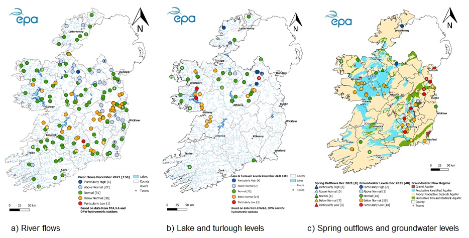
The bulletin provides a factual summary of river flows, lake levels, turlough and groundwater levels for the previous month. It includes a comparison to the long-term historic monthly values.
The bulletin also contains:
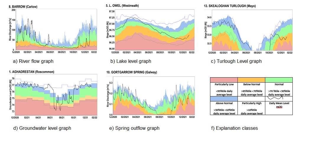
- Graphs showing river flow and water levels for a sample of the surface water and groundwater hydrometric stations across Ireland
- NEW: Graphs showing turlough levels from several GSI sites
- Maps which show how flows and levels at stations across the country compare to the average for the month
The hydrometric data used in the publication are produced from the EPA/local authority and OPW hydrometric networks. The weather summary information contained in the bulletin is provided courtesy of Met Éireann.
Read the Hydrology Summary Bulletins below.

Learn more
Find EPA/LA Hydrometric data on HydroNet.
Find provisional water level only data from OPW hydrometric stations on waterLevel.ie and archived water level and flow data from OPW hydrometric stations on Hydro Data.
Find information and turlough and borehole level data from GSI hydrometric stations on gwlevel.ie.
Access to this month’s Met Éireann and historic weather statements.