River levels
We collect information on water level height (also referred to as stage) from hydrometric stations using a variety of automated recorders. The water level data are measured every 15 minutes. Most of our stations transmit water level data directly through telemetry systems to our central database a few times a day. This is published on HydroNet a few hours later.
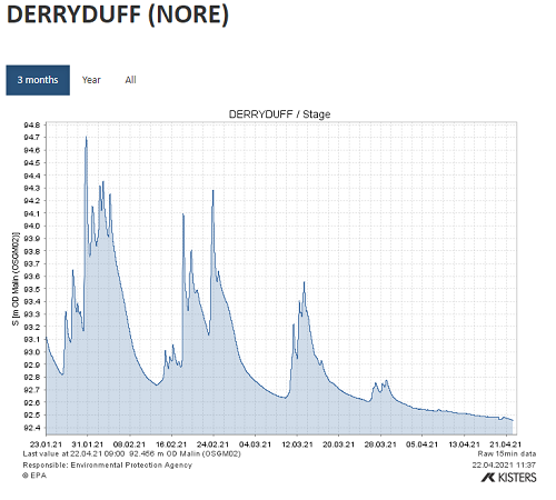
Example of water levels in the River Nore at Hydrometric station Deryduff (15053)
River flows
Although water level height is valuable information on its own, we are also interested in volumetric flows. This the amount of water flowing through a river at any given point in time. The standard unit of measurement is the cumec or cubic metre per second.
It is frequently not practical to measure continuous flows in a river. Most flow devices can only measure flow at one point in time. Therefore, we rely on the relationship between water level height (stage) and volumetric flow (discharge) at each hydrometric station. This relationship is known as a rating curve and it requires many flow measurements to be taken at different river level heights, from low flow to flood flow.
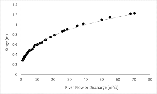
Example of a rating curve at a hydrometric river station.
Rating curves need to be revised because natural or man-made changes to the river banks and river bed can occur along a river over time. For example, a lot of weeds in the summer months can choke a river and completely change the rating curve at a hydrometric station. Therefore, the river channel must be regularly maintained and managed to ensure that good data on water level and flow are gathered.
Flow measurements
The principal methods of flow measurement we use are:
- Velocity-area method
- Acoustic Doppler Current Profiler (ADCP)
- Structures (e.g. weirs)
Velocity-Area method
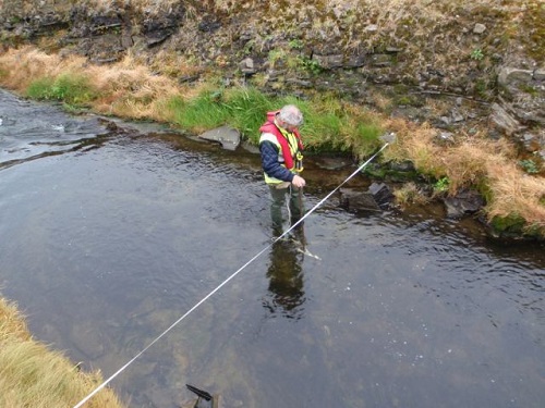
The velocity-area method has been used for many decades, with the aid of a handheld mechanical current meter. Current meters come in different sizes, depending on the size of the river. They work by measuring the rotations of propellers and calculate the speed (velocity) of the water. The flow is obtained by measuring the velocity for several vertical subsections across the river and calculating the flow in each. The overall flow is the combined flow from each of these subsections.
Photo of a velocity-area method using a current meter along a river transect.
ADCP
ADCP methods have become more popular in recent decades as technology advances. They work by transmitting sound into water and measuring the return signal to measure velocity and the cross-sectional area of the river. The ADCP device is commonly attached to a small boat which is guided manually or controlled remotely across the river. Other ADCP devices can be operated to measure the velocity in a vertical subsection, like the current meter.
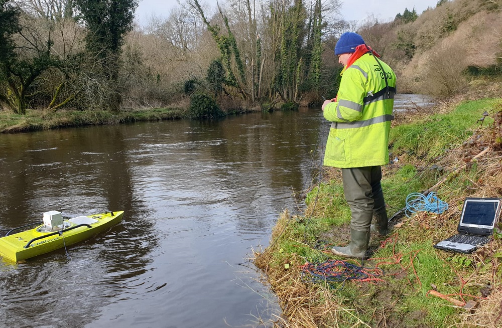
Photo of ADCP method using a remote-controlled boat.
Structures
Structures, in the form of notches and weirs, are engineered to measure flows and are ideal on small rivers. The water level height and mathematical formula are used to calculate the flow, based on the design of the weir.
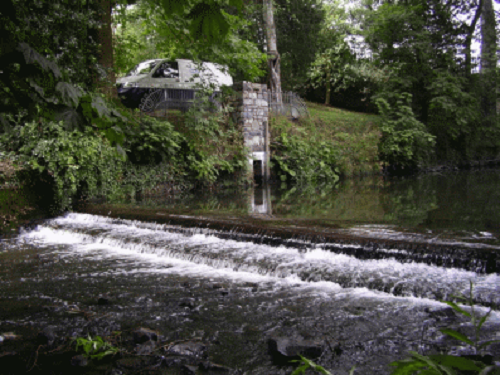
At some hydrometric stations, structures such as weirs and channel controls have been constructed to facilitate the measurement of river flows. These structures stabilise river channel conditions and help to overcome the problems caused by weed growth.
Photo of a broad-crested weir.
Data on water levels and flows for hydrometric stations are on HydroNet.